We were intrigued by Raufarhoefn, the northernmost
port on mainland Iceland, located just three miles south of the arctic circle.
After tying up to the floating dock in the fishing harbour we headed over to
the hotel for a drink. The chef said we were welcome to use the wifi but it was
expensive. Krystina realized he was joking and replied, isn’t everything in
Iceland? Then roamed the building to find enough internet signal to upload
photos.
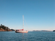
Snow Dragon Before The Fog, Raufarhoefn
It had been a clear afternoon when we arrived but
within minutes of settling into the hotel bar, fog rolled in completely
cloaking the town. The air was cold and damp as we walked back to Snow Dragon, hopeful
the fog would clear by the time we finished dinner. A yacht in Raufarhoefn was
an unusual sight and some of the local fisherman walked along the dock to get a
closer look at Snow Dragon. They seemed happy with us just waving from the
pilothouse while we ate our dinner.
Snow Dragon In Fog, Raufarhoefn
When the fog showed no sign of dissipating, we
decided to go for a walk anyway and headed for the ruins that we saw when we
first entered the harbour. On the way, the road took us through the nesting
grounds of arctic terns. Though we never left the road and their chicks had
already flown, they still felt we where a threat and dived at our heads threating
to attack us. To deter them, we found a couple of sticks that we held above our
heads to prevent them from getting too close. We kept our sticks for the walk
back while we toured the ruins which turned out to be a modern henge that was still
under construction.
Modern Henge, Raufarhoefn
The fog was still thick when we returned to Snow
Dragon and we made hot chocolate while we debated sleeping for a few hours in hope
of the fog clearing or moving on. In the end we decided to head out at 1.30 in
the morning with virtually no visibility. Krystina backed Snow Dragon off the
dock and carefully followed the range markers and used our incoming track on
the plotter as a reference. While being careful not to let the fog completely
disorientate her as the rocks on either side of the channel made brief, ghostly
appearances.
The one comforting thing about navigating with
limited visibility in Iceland is that
all Icelandic vessels are required to run AIS, an automatic tracking system. This
means that since we also have AIS, our system will pick up another vessels signal
and display their position and course on our chartplotter. In addition to our
radar, it greatly reduces our risk of running into another vessel.
At 6am the wind came up suddenly and
cleared the fog. It was nice to be able to shut off the engine and sail even if
the fluky wind made it difficult to settle on an ideal sail trim. We hoped to see whales as we passed Skjalfandafloi, outside of Husavik, but the wind had increased and the sea was rough making it impossible to
tell the difference between a whale and the splash of a wave.
Flatey
The wind finally settled into a consistent pattern
by the time we neared Flatey, an island that we are especially fond of from our
previous visit. Though it was tempting to continue sailing we were also fairly
certain the wind was going to disappear or go west fairly soon and decided to
stop. There was more protection by anchoring in Flateyjardalur on the mainland side across from
Flatey. While we were about to sit down for dinner, Krystina heard a boat
approaching which turned out to be a zodiac full of men in survival suits and
helmets. It turned out we had alarmed the coast guard by anchoring in an
unusual location and turning our AIS off and they had sent the boat out to
check on us.
View
Of Flateyjardalur
The following morning we continued on
to Siglifijordur and as we were crossing Eyjafjordur we finally spotted another
whale. The lone humpback kept its distance and it wasn’t until we continued
that we noticed a few other whales were feeding along the shore in the
distance.
Fluke Of A Humpback, Eyjafjordur
For more photos please click on Raufarhoefn Album


Nice to see you!!!
ReplyDelete